Foxborough, Mass.
The area now known as Foxborough was inhabited by native americans before the colonists arrived as early as 1704. In 1778, the town was incorporated and named for the Honorable Charles James Fox.
Often refered to as "The Gem Of Norfolk County", Foxborough is located equidistant from Boston, MA, and Providence, RI.
Water & Sewer
- Interbasin Decision For Foxborough
- Senate No. 2349: Amendment to House Bill establishing a Regional Wastewater District for the Towns of Mansfield, Foxborough, and Norton
- House No. 4307: aAn Act Establishing a Regional Wastewater District for the Towns of Mansfield, Foxborough, and Norton.
For legislation to establish the MFN water district. Approved, May 5, 2010. - Neponset River Watershed Assessment
- Neponset River Watershed Summary
- CWMP ENF
- MHD/MEPA: Patriot Place 4/20/2007
- Phase IV of the Comprehensive Wastewater Management Plan
- Total Maximum Daily Loads of Bacteria for Neponset River Basin
- (SWAP) Report for Foxborough Water Department
- Part II: Self-Assesment
- Map Of Voting Precincts
- Request for Determination of Applicability Under the Interbasin Transfer Act
- ANNUAL TOWN MEETING, MAY 14: Advisory Committee recommendations May 10, 2012 10:49 AM EDT
- Town wins water suit May 10, 2012 10:49 AM EDT
- Town hires new water chief April 5, 2012
- Foxboro taps Easton man as water chief April 5, 2012
- YOUR LETTERS: Former water/sewer chair recounts role in negotiations with Kraft Group April 5, 2012
- Lack of snow, rain may mean upcoming water shortages Monday, March 26, 2012
- Study will determine cost of expanded sewer
- YOUR LETTERS: How will town water supply handle Wynn resort features? March 15, 2012
- Study will determine cost of expanded sewer (Feb. 23)
- Mansfield eyes site for wastewater discharge 2/2
- Unity is goal for sewer project January 14, 2010
- GUEST COLUMN: Regional sewer commission: Not perfect, but progress July 1, 2010
- Towns reach deal on sewers September 24, 2010
- Town takes control over sewer plans November 4, 2010
- Tech park offers promise of 4,000 jobs March 12, 2009
- Kraft Group submits plans for office park March 5, 2009
- Cutback sought in Foxboro sewer costs May 16, 2008
- Foxboro backs sewer plan February 27, 2008
- VFoxboro Voters to Decide On Sewers June 01, 2007
- Krafts building a $350m Patriot Place complex, and a legacy May 20, 2007
- Comprehensive Patriot Place Review Committee & Report
- Kraft buys Route 1 lot for $10M April 11, 2006
Laws
Studies, Reports, Policies, Filings, & Agreements
Newspaper Articles, Columns, & Letters
Transportation & Corridors
- Getting Here & Once You're Here
- Accidents In Foxborough
- Traffic Counts
- Foxborough/Walpole: I-95 South Corridor Study by VHB
- Project 601782 - FOXBOROUGH- Roadway Reconstruction in thed CENTRAL BUSINESS DISTRICT
- Project 602661 - FOXBOROUGH- Traffic Safety Improvements at OAK STREET
- Project 600283 - FOXBOROUGH- Reconstruction of NORTH STREET, from ROUTE 1 to ROUTE 140
- Roadway Projects - Foxborough
- MHD District 5
- Traffic Counts for Foxborough
- Manual on Uniform Traffic Control Devices - Federal
- Manual of Uniform Traffic Control Devices - Massachusetts Amendments
- 2000 Highway Capacity Manual Blurbs - ^
- Interstate 95 (Massachusetts-South of Boston Section)
- MHD/MEPA: Patriot Place 4/20/2007
- Future Conditions 2009
- I-95 South Corridor Transportation Study 2009
- The Transportation Planning Process
- Massachusetts Association of Regional Transit Authorities
- Foxborough Route 1 Economic Development Study - December 2015
Foxborough Trains & Rail Lines
- The Boston and Providence Railroad was incorporated June 21, 1831.
- Old Colony Railroad operated from 1845.
- The Mansfield and Framingham Railroad was incorporated in 1862 as the Foxborough Branch Railroad to provide a rail connection from Mansfield through Foxborough to Walpole. In 1867, the name was changed to Mansfield and Framingham Railroad. The 22.1 mile line was completed on May 1, 1870.
- New York, New Haven, and Hartford Railroad
- The train arrived in North Foxborough (a.k.a. Morseville) in 1886.
- Norfolk & Bristol Electric Railroad's spur line to Lake View ballroom was discontinued in 1919.
- The East Foxboro station closed in November 1977.
- The Foxboro Stadium stop is part of the Boston, Clinton, Fitchburg and New Bedford Railroad, Old Colony Railroad, New York, New Haven and Hartford Railroad, Conrail, and now CSX line. The line connects to the MBTA's Franklin Line at Walpole and the Providence/Stoughton Line at Mansfield.
- For deeds, easements, sales, and more, see also: Consolidated Rail Corporation 1978+, New York Central Lines, etc.
- Draft 495 Rail Study
- 2010 Commuter Feasibility Study Report
- Foxborough Commuter Rail Feasibility Analysis"
- Football Trains to Gillette Stadium
- South Coast Rail Corridor Plan
- South East Corrider Rail Map
- Northeast Corridor Main Line
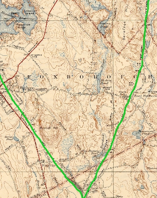
- * Rail lines in Foxborough are shown in lime green on map.
- Auto
- Rail
- Walking
- Bike
Route 1
a.k.a. Lower Post Road, Norfolk and Bristol Turnpike, and Washington Street
1784: Lafeyette House
1947: Bay State Raceway
1971: Schaefer Stadium
2002: CMGI Field
2007: Patriot Place
Route 140
Foxfield PlazaFoxborough Plaza
Downtown
Chestnut Green
Main Street
Mechanic Street
South Street / Route 106
Modes
Modes
What Is Transportation Planning?
Transportation helps shape an area's economic health and quality of life. Not only does the transportation system provide for the mobility of people and goods, it also influences patterns of growth and economic activity by providing access to land. The performance of the system affects public policy concerns like air quality, environmental resource consumption, social equity, land use, urban growth, economic development, safety, and security. Transportation planning recognizes the critical links between transportation and other societal goals. The planning process is more than merely listing highway and transit capital projects. It requires developing strategies for operating, managing, maintaining, and financing the area's transportation system in such a way as to advance the area's long-term goals.
Neighborhoods In Foxborough
Lakeview, Donkeyville, Paineburg, Quaker Hill, Morseville, Foxvale,
and Powderhouse are some of the older neighborhoods in town.
Cannon Forge, Witch Pond, Governor's Meadow, and Chestnut Green are a few of the newer developments.
Welcome to my site about Foxborough, Massachusetts!
Begun many years ago, the site is slowly growing to include more information about our borough, sometimes spelled Foxboro. I am hoping to expand the information contained here so the site will be helpful to residents, visitors, and other interested parties. More features and functionality will be added slowly but surely.
If you own a business in town, are part of a Foxborough based group or club, or have something you woud like to see, list, or include here, please let me know! There is no charge.
Thanks! And, hope you have fun exploring here!
Users use this site and the information contained herein at their own risk.
Crafted by 
Powered by American Ingenuity!
© 1998-present